
By AkashicNET · u/NeuronsToNirvana
Water resilience means preparing for how water moves through our homes, streets and landscapes. Give rainfall suitable places to slow or gather; assess water quality and overflow routes; maintain the systems; and make sure warnings reach people who can act. Success depends on local conditions, ecological care and fair treatment of affected communities.
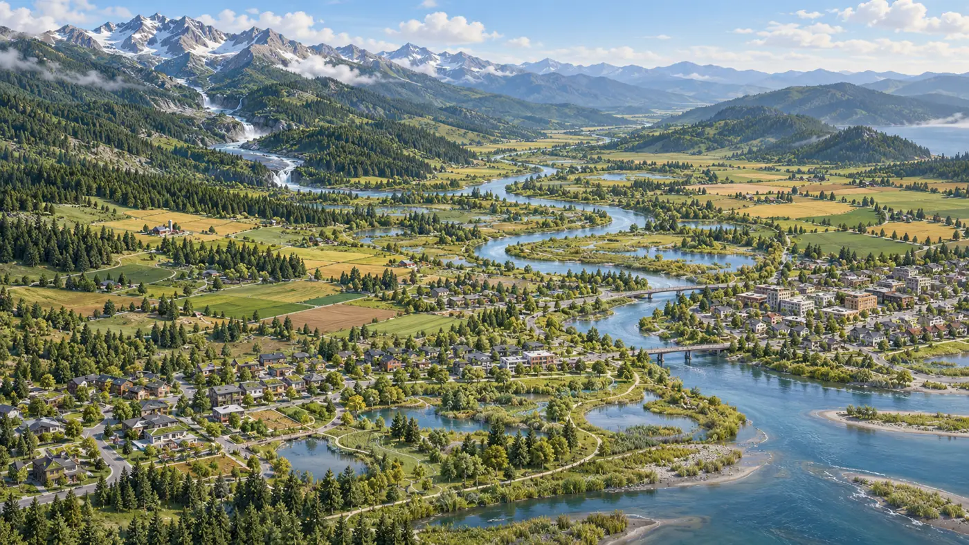
Too much water arriving too quickly can become a flood. Too little available at the right time can threaten communities and ecosystems. This instalment concentrates on flood and catchment resilience, while keeping that wider water-security picture in view.
Biology offers two brief parallels. CAM plants can reduce water loss by taking up carbon dioxide mainly at night.[1] Engineered bacterial colonies can pass molecular signals through laboratory circuits; proposed agricultural uses remain prospective.[2] These are prompts for thinking about timing and response. They do not establish a shared mechanism with water-management methods. The fuller plant-intelligence discussion belongs in a future ADAPT instalment.
1. Follow the Whole Catchment
A catchment is the area from which water drains towards a shared outlet. A household, farm or town sits within this larger network.
UNESCO’s Mountains and Glaciers: Water Towers report describes how mountain snow and ice store water and release it seasonally. Climate-driven changes affect the flows on which downstream communities and ecosystems depend.[4]
Our planning question: does an intervention improve resilience across the catchment, or move a problem somewhere else? Who receives protection, and who bears the costs?
2. Give Water Somewhere to Go
Rain gardens, permeable surfaces, retention areas and protected floodplains can slow or reduce runoff. The “sponge city” idea gives rainfall opportunities to infiltrate, be stored or follow designed pathways. EPA guidance supports combining green infrastructure with drainage and other engineered measures according to local conditions.[5]
Infiltration needs assessment. EPA monitoring at three sites found changes in groundwater chemistry, although the traditional stormwater contaminants measured there did not pose a health concern. Those results reinforce the importance of local geology, water quality and monitoring.[5]
Wetlands and floodplains also have ecological value. Our proposal is to assess restoration through both ecological outcomes and measured flood performance, including what happens when a system’s protective capacity is exceeded.
3. Make Room for Rivers, With Communities
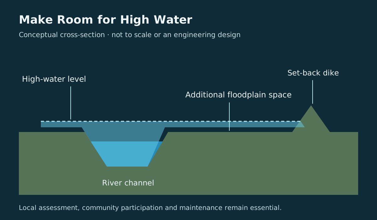
The Netherlands’ Room for the River programme includes moving dikes inland, creating side channels and lowering floodplains to increase capacity. Rijkswaterstaat also acknowledges social costs: some residents and businesses may need to move.[6]
Our ethical proposal: planned retention and managed flooding should involve affected communities, clear responsibilities and fair treatment. Compensation where appropriate, maintenance commitments and attention to displaced risk belong within the definition of success.
4. Connect Warnings to Action
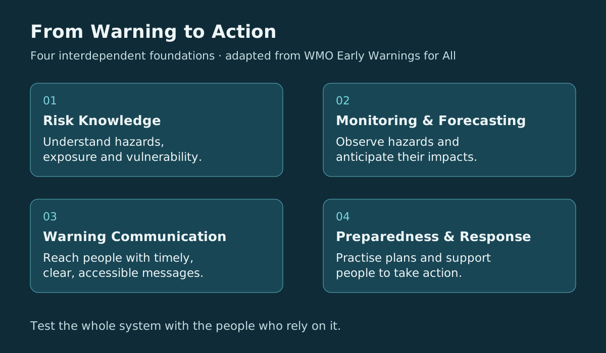
The World Meteorological Organization identifies four foundations for effective early warnings: understanding risk; monitoring and forecasting hazards; communicating warnings; and preparedness to respond.[7]
Our practical inference is straightforward: a forecast has limited value if its message arrives too late, cannot be understood, or reaches someone without support or a safe destination. A resilience plan should test the whole chain with the people expected to use it.
5. Make Care and Maintenance Ordinary
ADAPT synthesis: start with manageable questions appropriate to the place and the people involved.
- Home or building: understand supply, leaks, drainage and local alerts. Identify who maintains each system and who needs help when it fails.
- Garden or farm: assess soil, crop suitability and water-use patterns. Check whether a change improves measured outcomes.
- Street or neighbourhood: compare retention, permeable surfaces and drainage, accounting for geology, water quality, maintenance and overflow routes.
- River catchment: assess floodplain space and upstream/downstream effects. Include the people who gain protection or bear costs.
- Community preparedness: test whether people can receive, understand and act on a warning.
These are starting questions for assessment, not universal engineering prescriptions.
6. Measure Outcomes and Keep Revising
The IPCC identifies constraints including governance, finance, information and water availability, as well as biophysical limits in some settings. It also warns that adaptation can create new vulnerability or deepen inequality.[3]
Measurements may show that a scheme fails in the events it was meant to address, changes water quality, shifts risk downstream or imposes unacceptable costs. Those findings should change the recommendation.
AkashicNET could record each intervention’s setting, evidence, outcomes, maintenance needs, trade-offs and unresolved questions. Unsuccessful interventions should remain visible. This is a proposed role for the Living Knowledge Commons, not an existing validated water-planning service.
What works, under which conditions, for whom, and for how long?
Water resilience is a practice of attention, preparation and shared responsibility. Let the evidence guide the work. Let care determine whom the work serves.
Evidence boundary: cited findings and institutional guidance support the reported mechanisms and approaches. The connections and practical questions are AkashicNET/ADAPT interpretation. The plant examples do not establish subjective awareness.
Sources and Further Reading
- CAM research. Kramml, H. M., Herpell, J. B., et al. (2026). Clusia genomes shed light on the evolution and diversity of crassulacean acid metabolism physiotypes. Nature Communications 17, 3937. Read the full text in PubMed Central. Details also checked against the University of Vienna’s research explanation (5 May 2026).
- Bacterial circuits. Doosthosseini, H., Chen, H., and Voigt, C. A. (2026). Living circuit boards built by printing bacterial transistors. Nature Chemical Biology, published 17 August 2026. Primary abstract and MIT News explanation by Anne Trafton consulted.
- Water risks, adaptation and limits. IPCC (2022). AR6 Working Group II, Chapter 4: Water, particularly sections 4.7.1 and 4.7.4. See also the Summary for Policymakers, sections C.3 and C.4.
- Mountain water systems. UNESCO, on behalf of UN-Water (2025). United Nations World Water Development Report 2025: Mountains and Glaciers: Water Towers. Official report overview consulted.
- Green infrastructure and water quality. US Environmental Protection Agency. Mitigate Flooding; and Assessing Impacts of Green Infrastructure on Groundwater Quality (19 April 2021).
- River-space adaptation. Rijkswaterstaat. Room for the River. Official programme account, including site-specific measures and social trade-offs.
- People-centred early warnings. World Meteorological Organization. Early Warnings for All. Official description of the four warning-system pillars.
Discovery trail: the earlier conversation was prompted by SciTechDaily’s CAM coverage and discussed living bacterial circuits. The corresponding bacterial circuit coverage is included for context. These are secondary explanations, not additional independent experiments.
Transparency and Evidence Boundaries
Evidence: CAM physiology and the reported bacterial circuit results are research findings. Agricultural extensions remain prospective. Water-management examples are established approaches whose suitability and outcomes depend on location.
Interpretation: the connections between timing, sensing, storage, response and care are ADAPT/AkashicNET synthesis. They are not a single mechanism established by all seven source groups.
User contribution: the publication concept, series direction and request to bring the earlier material together. AI assistance: recovery of context, source retrieval, drafting, synthesis and editorial review. The research findings belong to the cited authors and organisations. No measured percentage attribution is claimed.
Review scope: the bacterial paper’s abstract and MIT account were accessible. The CAM paper’s full text is linked through PubMed Central, although direct retrieval was blocked in this drafting session; its details were checked against the originating university’s explanation and bibliographic records. The full IPCC chapter could not be opened in this session, so IPCC claims were checked against indexed official assessment text. Other linked institutional pages were consulted. This is a source-grounded public synthesis, not a full methods audit, exhaustive literature review or independent replication.
Community cross-check: earlier discussions and available saved material were searched. Exact links to the prior CAM community post and any earlier complete ADAPT001 manuscript were not recovered, so neither is presented as verified provenance. The bacterial publication above fits the earlier circuit discussion, but its identity as the exact previously shared link is unconfirmed.
Editorial review: two passes completed: source and claim checks, followed by clarity, evidence labels, citations and reading-time checks. Both passes were AI-assisted editorial work, not independent peer review.
Contribution estimates: the earlier proposed split was contributor direction 10%; AkashicNET/ADAPT framing 15%; cited sources 30%; AI retrieval, drafting and editorial review 25%; AI synthesis and augmentation 20%. These are subjective editorial allocations without a quantitative method, not measured word counts, effort, ownership or scientific validity. They should be read alongside the role descriptions above.
Visuals: the catchment is an AI-generated imagined landscape. The floodplain cross-section and warning foundations are original explanatory schematics, not measured data or site-specific designs.